1. Route Character & Riding Dynamics
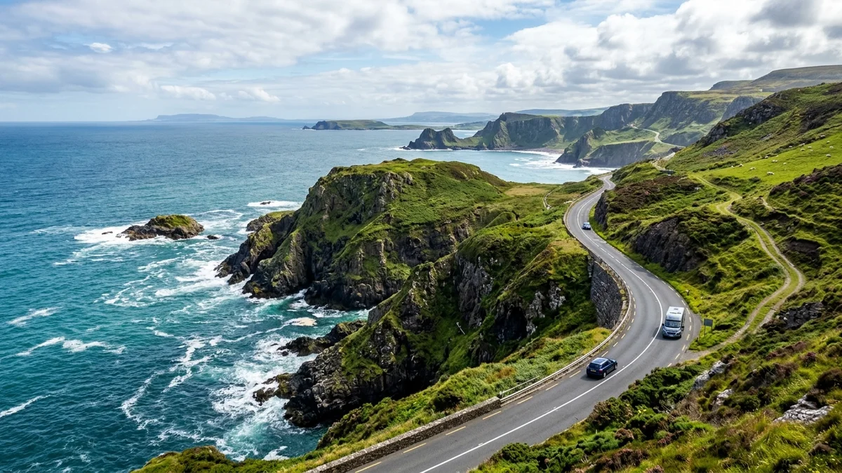
A taste of the Causeway Coast follows the A2 Coastal Route across Antrim Coast in Northern Ireland. The road character is defined by Coastal cliffs, sea views, seaside harbour descents & hedgerow curves, taking riders across About 19 miles (31 km) of sweeping topography.
Exposed coastal Atlantic crosswinds on headlands, agricultural tractors emerging from blind hedge lanes, tight hairpins down into Ballintoy Harbour, and tourist coach traffic around the Giant’s Causeway.
2. Recommended Waypoint Breakdown & Timeline
While continuous riding takes roughly 35–45 mins riding, the ideal motorcycle tour allows time for viewpoint stops, coastal photography, fuel margins, and legendary local cafés. Here is a recommended time-blocked itinerary:
Depart Ballycastle: Fuel & Safety Checks
Top off fuel at Maxol on the A2, inspect tyre pressures for cold sea-level tarmac, and wipe visor clean before exposed headlands.
Ballintoy Harbour: Technical Descent & Coffee Stop
Negotiate the 1-in-5 single-track descent down Harbour Road. Enjoy fresh scones at Roark’s Kitchen and explore the limestone sea stacks and Game of Thrones filming quay.
Bushmills: Artisan Lunch & Distillery Photo Stop
Ride past Whitepark Bay into historic Bushmills. Enjoy artisan coffee or lunch at The French Rooms and capture a photograph outside the 1608 Old Bushmills Distillery gates.
Portrush Harbour: Coastal Finish & Harbour Seafood
Roll past Portrush East Strand toward the harbour wall. Traditional fish & chips overlooking West Bay and the Skerries, with panoramic views of the Donegal headlands.
3. Legendary Biker Cafés & Motorcycle Parking Intel
Motorcycle safety doesn’t end when the engine cuts out. Steep cambers, loose gravel, and coastal slipway seaweed can easily topple a 220 kg touring bike. Here is verified parking surface intelligence for each stop along this route:
Ballintoy Harbour & Roark’s Kitchen
Famous winding descent to a sheltered limestone fishing harbour with rugged sea stacks, outdoor café seating, and fresh seafood.
The French Rooms
Boutique café and bakery in historic Bushmills, ideal for speciality coffee and artisan lunches before visiting the world’s oldest licensed whiskey distillery.
Ramore Wine Bar & Harbour
Popular coastal motorcycle meeting point on the harbour wall, with views across West Bay toward Donegal and lively fish & chip stops.
4. Turn-by-Turn Highlights & Technical Hazards
First-time visitors can be caught off-guard by abrupt shifts in road geometry, severe maritime gusts, or blind farm junctions. Stay alert at these specific technical checkpoints:
B15 Descent to Ballintoy Harbour — 1-in-5 Steep Descent & Single-Track Hairpins
Narrow single-track spur dropping at a 20% gradient through blind rocky hairpins with passing places. Tour coaches and oncoming campervans frequently block both lanes.
Whitepark Bay Coastal Plateau — Atlantic Crosswind Shear Corridor
Elevated cliff plateau exposed directly to the North Atlantic. Westerly and northerly crosswinds buffet bikes violently when exiting tree-lined hedge cuttings into open cliff views.
Bushmills & Portrush Village Approaches — Tourist Traffic & Mini-Roundabouts
Multiple tight roundabouts and pedestrian crossings. Heavy holiday traffic, sightseeing coaches, and foreign rental cars making abrupt turns toward the Giant’s Causeway.
5. Live Weather, Tidal & Road Disruption Feeds
Maritime headlands and mountain passes experience rapid microclimate swings. Before setting off, consult these verified live operational feeds:
Met Office Coastal & Inshore Waters Gale Warnings
Crucial for checking gale warnings (Force 6+) and sea mist (haar) across Rathlin Sound and the North Channel before departure.
Ballintoy Harbour & North Coast Tide Tables
At high spring tide combined with northerly swells, waves wash directly over the lower Ballintoy slipway and car park apron.
Trafficwatch NI & Live PSNI Road Watch
Real-time road closures, agricultural machinery delays, surface dressing works, and NW200 race-week road diversion notices.
6. Visitor Quick-Sheet: Emergency & Gear Checklist
Keep this essential safety and breakdown reference handy when touring Antrim Coast:
Dial immediately for road collisions. State nearest townland and mile marker.
For coastal cliff falls, tidal strandings, or harbour water emergencies along the shoreline.
Essential for parking on sloping harbour stones, unpaved lay-bys, and damp verges along coastal viewpoints.
Atlantic ocean spray and rapid temperature drops near the water cause instant visor fogging without a double-glazed insert.
Sea mist (haar) rolls in from Rathlin Sound in under 10 minutes, cutting coastal visibility to under 50 metres.
Airborne ocean salt deposits dry into a hazy abrasive film; wiping it dry will scratch visor coatings.
7. Fuel Margins & Logistics
Fuel up in Ballycastle (Maxol / Spar stations on A2) or in Bushmills and Portrush. Fuel is readily accessible along the entire North Coast corridor.
Recommended Window: May to September. Early May coincides with the world-famous North West 200 road racing festival, bringing thousands of enthusiastic riders and incredible road atmosphere.
8. Official Sources & Responsible Riding
For official local council travel alerts, seasonal road repairs, and regional tourism guidance, consult:
Tourism NI: Causeway Coastal Route ↗