1. Route Character & Riding Dynamics
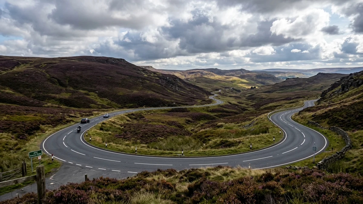
The Snake Pass follows the A57 across Peak District in England. The road character is defined by Moorland curves, off-camber hairpins & reservoir woodland, taking riders across About 13 miles (21 km) of sweeping topography.
Frequent road subsidence dips from hillside slippage, tight downhill off-camber hairpins on the Glossop descent, and unfenced moorland sheep crossing the carriageway without warning.
2. Recommended Waypoint Breakdown & Timeline
While continuous riding takes roughly 25–35 mins riding, the ideal motorcycle tour allows time for viewpoint stops, coastal photography, fuel margins, and legendary local cafés. Here is a recommended time-blocked itinerary:
Depart Glossop: Fuel & Tyre Warmup
Fill up at Tesco or BP on the A57, inspect tyre pressures, and allow tyres to warm as you climb out of the urban boundary.
Snake Summit: High Moorland Crossing
Cross the open Pennine plateau at 1,680 feet. Take in wide heather vistas and maintain vigilant scans for roaming Swaledale sheep.
Derwent Valley: Coffee & Dambusters Dam
Descend through the pine woodland into the Upper Derwent Valley. Park in dedicated bike bays for coffee and view the Derwent Dam towers.
Ladybower Reservoir: Coastal Finish
Roll across the A57 Ladybower viaduct toward Bamford or divert via the Strines Inn for a traditional moorland lunch.
3. Legendary Biker Cafés & Motorcycle Parking Intel
Motorcycle safety doesn’t end when the engine cuts out. Steep cambers, loose gravel, and coastal slipway seaweed can easily topple a 220 kg touring bike. Here is verified parking surface intelligence for each stop along this route:
Fairholmes Visitor Centre & Derwent Dam
Dedicated motorcycle parking bay, takeaway kiosk, picnic tables, and historic view of the Dambusters practice reservoir.
Glossop High Street & Cafés
Traditional bakeries, coffee shops, and independent tearooms serving hearty breakfasts before heading east over the pass.
The Strines Inn
Historic 13th-century coaching inn tucked off the A57 toward Sheffield, renowned for peacocks and stone-flagged hospitality.
4. Turn-by-Turn Highlights & Technical Hazards
First-time visitors can be caught off-guard by abrupt shifts in road geometry, severe maritime gusts, or blind farm junctions. Stay alert at these specific technical checkpoints:
Glossop Hairpin Descent — Tight Off-Camber Curves & Damp Shade
Steep downhill sweeping turns under dense tree cover. The road surface remains damp long after rainfall, and leaves create slick patches in autumn.
Mid-Pass Moorland Peat Section — Hillside Subsidence & Sudden Bumps
Active geological slippage causes pronounced dips and undulations in the carriageway that can compress motorcycle suspension aggressively.
High Heather Moorland — Unfenced Moorland Sheep & Low Cloud
Swaledale sheep graze directly beside the tarmac and dart across the road unexpectedly. Rapid Pennine hill fog can reduce visibility to 30 metres.
5. Live Weather, Tidal & Road Disruption Feeds
Maritime headlands and mountain passes experience rapid microclimate swings. Before setting off, consult these verified live operational feeds:
Derbyshire County Council A57 Landslip & Snow Gate Feed
Check whether the pass is open, closed by snow gates, or restricted by single-lane traffic lights.
Met Office Peak District Moorland Weather Warning
Checks summit wind speeds, freezing levels, and low-cloud hill fog before you climb above 500 metres.
6. Visitor Quick-Sheet: Emergency & Gear Checklist
Keep this essential safety and breakdown reference handy when touring Peak District:
Ask for Derbyshire Police. In remote moorland terrain off the tarmac, request Edale Mountain Rescue Team.
Temperatures on the 512m summit can drop 5–8°C lower than Glossop or Sheffield valley floors.
Crucial when pulling onto soft peat or gravel verges to take photographs or check maps.
Dark smoke visors become hazardous when mountain clouds descend or when entering shaded valley woodland.
7. Fuel Margins & Logistics
Fill up in Glossop (Tesco / BP stations on A57) or Bamford/Hathersage on the Sheffield side. There are zero petrol stations or mobile signal masts along the high moorland pass itself.
Recommended Window: May to October. The A57 is notorious for being the first major English road blocked by drifting snow and black ice in winter; temporary traffic lights and landslip restrictions operate year-round.
8. Official Sources & Responsible Riding
For official local council travel alerts, seasonal road repairs, and regional tourism guidance, consult:
Derbyshire County Council: A57 updates ↗